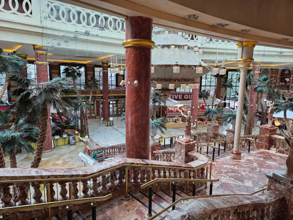
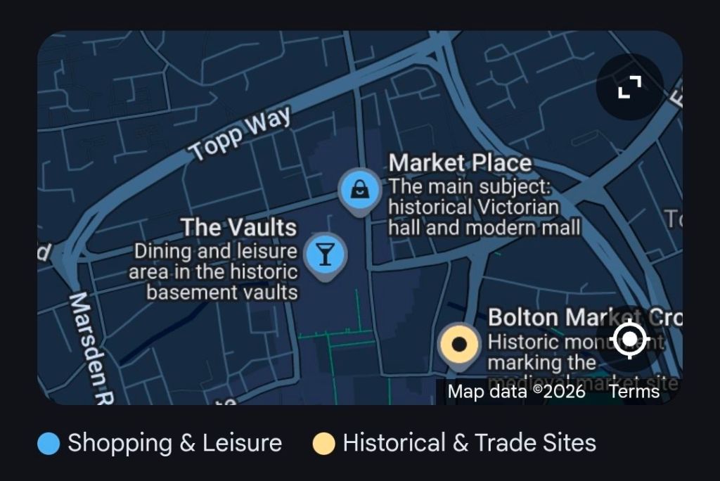
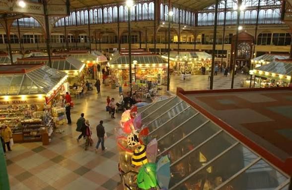
Bolton Market Place is a major retail and leisure destination in Bolton town centre, primarily housed within the Grade II listed Victorian Market Hall. Originally opened in 1855, it was once celebrated as the “largest covered market in the kingdom” and serves as a historical anchor for the town’s commercial heart.
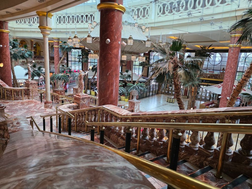
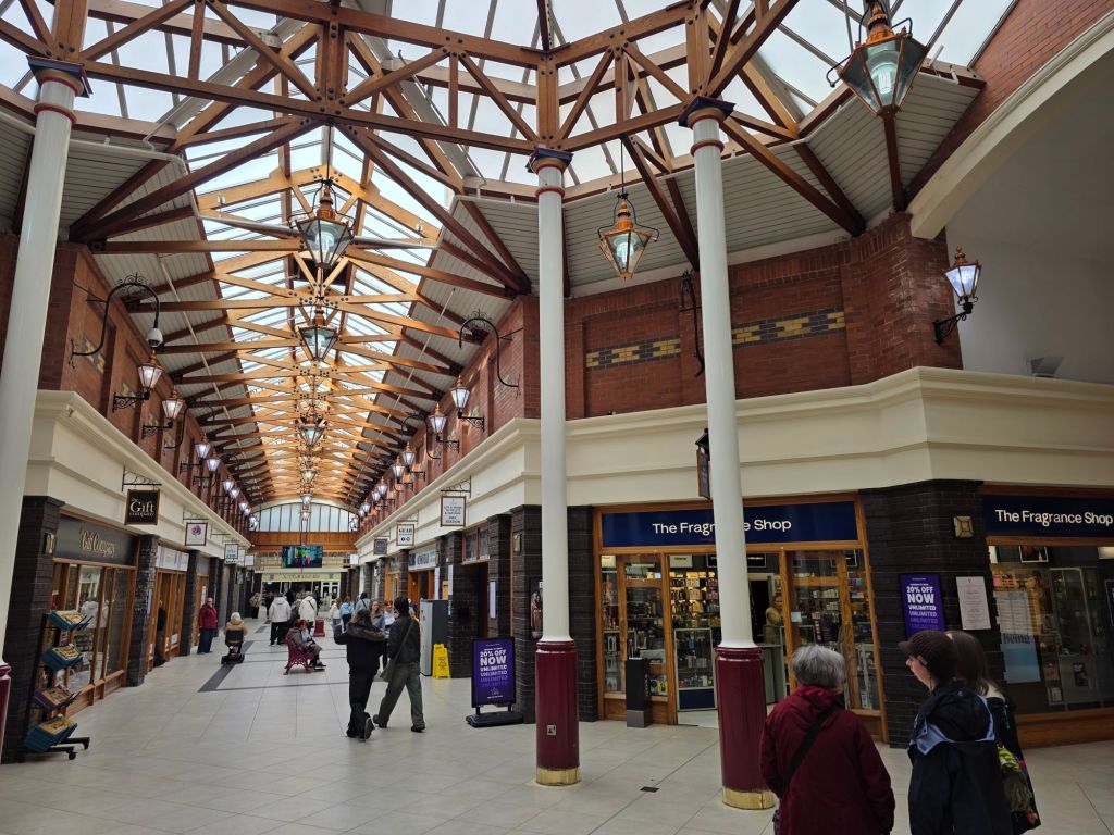
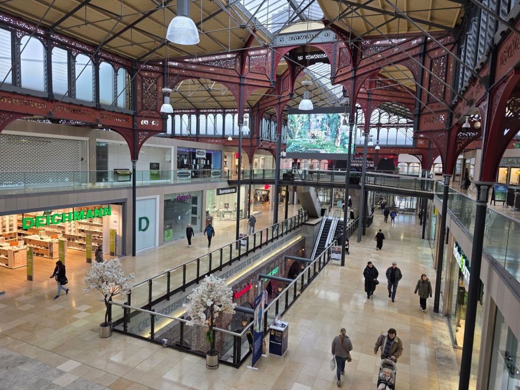
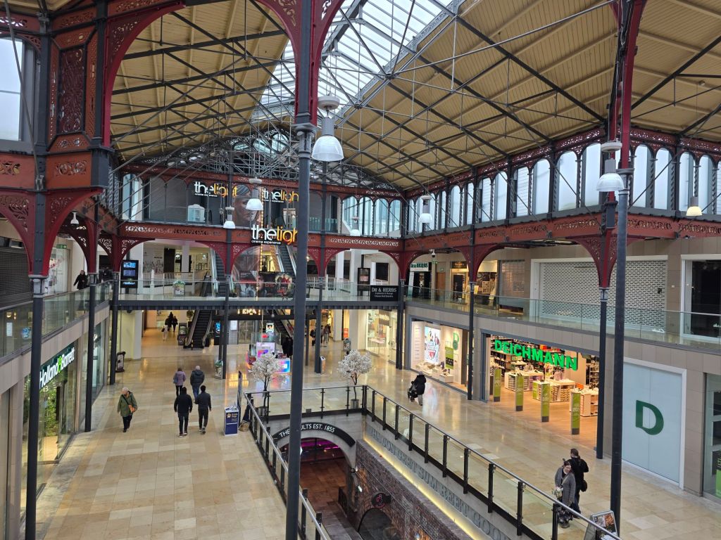
Market Place Bolton is a Grade II listed shopping and leisure destination located in the heart of Bolton town centre. Originally opened in 1855 as a covered market hall, it was once considered the largest in the kingdom. Today, it combines historic Victorian architecture—including its famous restored ironwork and glass roof—with modern retail and entertainment facilities.
Shopping & Major Retailers
The centre spans two floors of retail space and features a mix of high-street giants and independent boutiques.
- Key Retailers: Primark (new 40,000 sq ft store opened Dec 2024), Next, H&M, New Look, JD Sports, River Island, and Footasylum.
- Specialty Stores: Pandora, Hotel Chocolat, The Body Shop, and The Entertainer.
- Recent Additions: The Works (opened 2024) and Carrs Pasties (opened 2026).
Dining: The Vaults
The lower ground floor houses The Vaults, a converted Victorian basement that retains original stonework and atmospheric archways.
- Restaurants: Popular chains such as Nando’s and Prezzo, alongside various bars and cafes.
- Food Court: A vibrant hub for socialising with a range of global cuisines.
Leisure & Entertainment
Market Place has pivoted toward being a “leisure-first” destination to combat declining retail trends.
- The Light Cinema: A luxury 9-screen multiplex cinema located on the top floor.
- Family Activities: Includes Amazonia (kids’ play area with adventure golf and a train), an escape room, and an indoor crazy golf course.
- Events: The centre regularly hosts free events, such as art exhibitions and “Little Rascals” kids’ club activities.
Visitor Information
- Parking: On-site multi-storey car park with over 500 spaces. Offers competitive rates, often including incentives like one hour free.
- Accessibility: Fully accessible for disabled visitors, with dedicated parking and a free wheelchair service available from the Customer Service desk.
- Location: Knowsley Street, Bolton, BL1 2AL. It is roughly a 10-minute walk from the main bus and train stations.
Historical Timeline of Bolton Market Place
The Victorian Era: Foundation & Grandeur
- 1251: Bolton is granted a Royal Charter to hold a market, originally held on Mondays in the Churchgate area.
- 1482: The Market Cross is first established at the entrance to Churchgate as a landmark for trade.
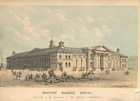
- 1855: The Bolton Market Hall officially opens on 19 December. Designed by architect G. T. Robinson, it cost £50,000 and featured a massive cast-iron and glass roof.
- 1865: A dedicated Fish Market is added next to the main hall at a cost of £30,000, further establishing Bolton as a major trading hub in the North.
- 1894: The hall undergoes its first major modifications, including the addition of exterior shops on Knowsley Street and Corporation Street.
Early to Mid-20th Century: Adaptation
- 1909: The current version of the Market Cross is commissioned with bronze plaques detailing the town’s history.
- 1932: The Victorian fish market is demolished as trade shifts toward the new Ashburner Street market.
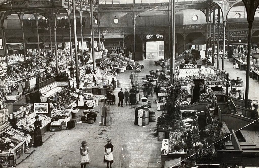
- 1938: The interior layout is modernised, replacing long rows of stalls with roofed islands to better manage foot traffic.
Late 20th Century: The Shopping Centre Era
- 1982: A competition to redevelop the site into a modern shopping mall is won by Chapman Taylor Partners.
- 1988: The refurbished site is reopened by Queen Elizabeth II as the Market Place Shopping Centre on 1 December.
- 1998: Sunday trading is briefly suspended in the Market Hall due to low trader turnout.
21st Century: Modernisation & Leisure
- 2004: Controversial plans to move traditional market stallholders out of the hall spark a petition with over 80,000 names.
- 2007: After 151 years of traditional trading, the last 50 stallholders move out to allow for a full retail conversion.
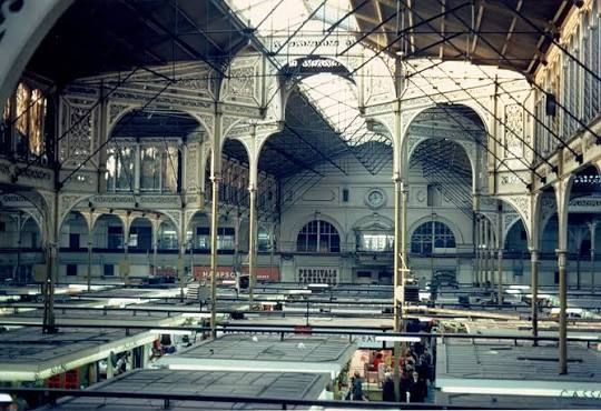
- 2008: The modernised Market Place, featuring units “slotted” into the historic listed structure, officially opens in October.
- 2013: The centre is acquired by Moorgarth, who announce a £15 million investment plan.
- 2016–2017: The development of The Vaults (dining/leisure in the basement) and a new 9-screen cinema on the roof is completed.
- 2025: The centre continues to evolve with ongoing development plans to further enhance its position as a leading regional destination.
Images through the years :

Bolton Market Place – About and Timeline History with Images